Half day
Scenic road, Hesitation Point, fire tower area, and one short lake or Civilian Conservation Corps Trail 2 walk.

Indiana's largest state park
Nearly 16,000 acres of narrow ridges and deep ravines begin beside Nashville. Drive the scenic road to Hesitation Point and the fire tower, then choose one trail or mountain-bike route.
Brown County State Park is the outdoor half of a Nashville weekend, not a single viewpoint beside town. The Indiana Department of Natural Resources (DNR) describes nearly 20 miles of tree-lined roads, hiking from paved vista paths to rugged ravines, a major mountain-bike system, Ogle and Strahl lakes, a Nature Center, campgrounds, the Abe Martin Lodge, and a 90-foot fire tower. The last glaciers did not flatten this terrain; narrow ridges, steep slopes, and gullies add repeated climbs to short routes.
Scenic road, Hesitation Point, fire tower area, and one short lake or Civilian Conservation Corps Trail 2 walk.
One longer ridge route, a lake loop, a Nature Center stop, and sunset from a vista.
Permit check, current trail report, a skill-matched loop, then food and recovery time back in Nashville.
Measured hiking choices
Distances and ratings below come from Indiana DNR. Times are generous visitor estimates, not official promises; wet leaves, roots, heat, stops, and linked trails can change the day.
Easy · paved
The clearest low-effort introduction and a good choice for mixed mobility. The park also offers a reservable motorized trail wheelchair.
Moderate
Choose this for a recognizable Brown County lake-and-forest walk without committing to the park's longer ridge routes.
Moderate
Stone bridges, steps, and retaining walls built by the Civilian Conservation Corps distinguish this loop from the park's lake and ridge routes.
Moderate
Check the property map before starting. This is not a neat parking-lot loop, so account for the return route.
Rugged
Pair the trail with the 90-foot tower only if heights and stairs suit the group; the tower view does not require hiking the full loop.
Rugged
The mileage is short, but the steep ravine slope makes this a rugged choice. Look for yellowwood habitat in the nature preserve.

A strong first visit
Begin with the DNR map and current notices. Hesitation Point and the fire tower area establish the ridge country quickly. Then choose Ogle Lake for water and woodland, Civilian Conservation Corps Trail 2 for stonework, or Hobbs Hollow Connector Trail 8 for a longer point-to-point route between park landmarks. The Indiana Department of Natural Resources (DNR) auto tour begins at the Nature Center and takes at least an hour before extra stops; the park speed limit is 30 mph, with slower travel on steep curves.
Mountain biking
Brown County Mountain Biking describes more than 30 miles in the state park, from beginner terrain to directional jump trails and technical rock-and-root riding. Ratings, permits, and trail conditions determine which loops are suitable on a given day.
Start with the beginner network near the main trailhead south of the swimming pool. Ask locally about the best current green loop rather than choosing by mileage alone.
Green Valley and Weed Patch are known for faster, flowing singletrack. Build an out-and-back or linked loop with the return climb in mind.
Hobbs Hollow, Gnawbone, Schooner Trace, and Walnut are specialist choices with jumps or technical rock-and-root riding. Confirm direction, rating, and conditions before entering.
Park entrance is separate from any required off-road cycling permit. Check Indiana DNR rules and Brown County Mountain Biking trail reports; wet trails should be left alone.

Season and access
A half day covers a scenic drive, two or three overlooks, and one short trail. A full day fits a longer hike or mountain-bike ride, the Nature Center, and unhurried stops before returning to Nashville.
Indiana DNR directs all RVs and vehicles towing trailers to the west entrance on State Road 46. The north entrance uses a historic covered bridge with 9-foot clearance and a 3-ton weight limit.
No. Fall color brings the heaviest demand, while spring adds wildflowers and fresh foliage, summer offers deep shade with heat and humidity, and winter reveals the ridge-and-ravine shape when roads and trails are clear.
Yes, but start with the beginner trail network, confirm permits and conditions, and do not drift onto advanced directional or technical trails. Local trail reports are more useful than an old screenshot.
Back in Nashville
Second Star gear guide
National Park Day Pack Guide
Trailhead packing list
Water, weather layers, trail comfort, binoculars, and the practical pieces that make overlooks and short hikes easier.
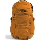
Daypacks & Packs
$86.93
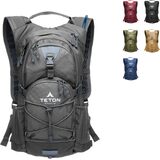
Hydration Packs
$59.99
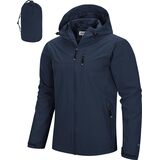
Packable Rain Jackets
$65.99